
In the dry valleys of Southern California, the Cahuilla knew places where water remained even after streambeds had dried up. In some places, water emerged naturally as a spring. Elsewhere, people had to descend into the ground to reach it.
The Desert Cahuilla called these wells temakawomal — an “earthen olla.” The name is preserved in the history of the Augustine Band of Cahuilla Indians. These wells were unlike narrow modern boreholes: a broad earthen passage descended in successive steps. A person could walk down to the water without needing a long dipper suspended on a rope.
How a temakawomal was constructed
People located a place where groundwater remained beneath the dry surface.
They dug an open depression with earthen steps, descending below the level of the surrounding desert.
At the bottom of the steps, they reached the water and could collect it directly where it came to the surface.
If the groundwater level fell, the descent could be extended farther downward. The steps made it possible to reach deeper water without changing the natural source.
The open arrangement had another feature. According to the tribal account, animals could also drink from these wells. For people in desert settlements, these were familiar watering places visited regularly.
Where the wells were located
Cahuilla settlements in the Coachella Valley stood near streams, springs, and places where groundwater could be reached through the soil. Sometimes pressure from underground brought water to the surface on its own. Where it did not, people created stepped earthen descents.
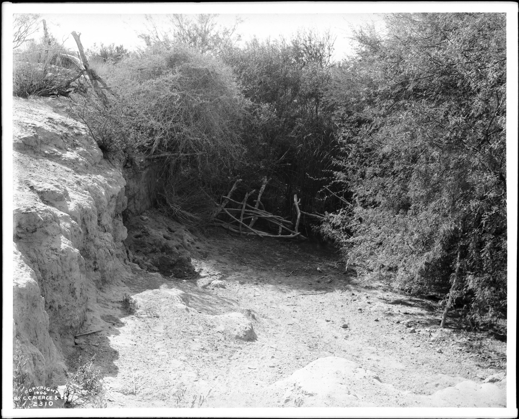
A historical photograph taken by Charles Chester Pierce around 1903 shows a Cahuilla well near Martinez. The earthen edge, a small depression, and dense vegetation around the watering place are visible.
Here, water and earth together formed the structure: the soil served as its walls, the dug steps as its staircase, and desert groundwater remained the source.
Sources: Augustine Band of Cahuilla Indians, “History & Heritage,” “Water Wells” — https://tribe.augustinetribe-nsn.gov/history-heritage/. Historical photograph: Charles C. Pierce, CHS-2310 — https://commons.wikimedia.org/wiki/File:Indian_well_at_Martinez,_showing_the_heavy_vegetation_around_it,_ca.1903_(CHS-2310).jpg.
